
New AI-powered research by CARE-C estimates the tree population in Cyprus
A new study by researchers of CARE-C at the Cyprus Institute has utilised high-resolution aerial imagery and artificial intelligence (AI), by developing a deep-learning neural network model to map and count the number of trees in selected areas in Cyprus. This research creates the basis for establishing the first national tree-level inventory of Cyprus, using airborne remote-sensing, an essential tool for effective carbon stock assessment and land-based mitigation strategies.
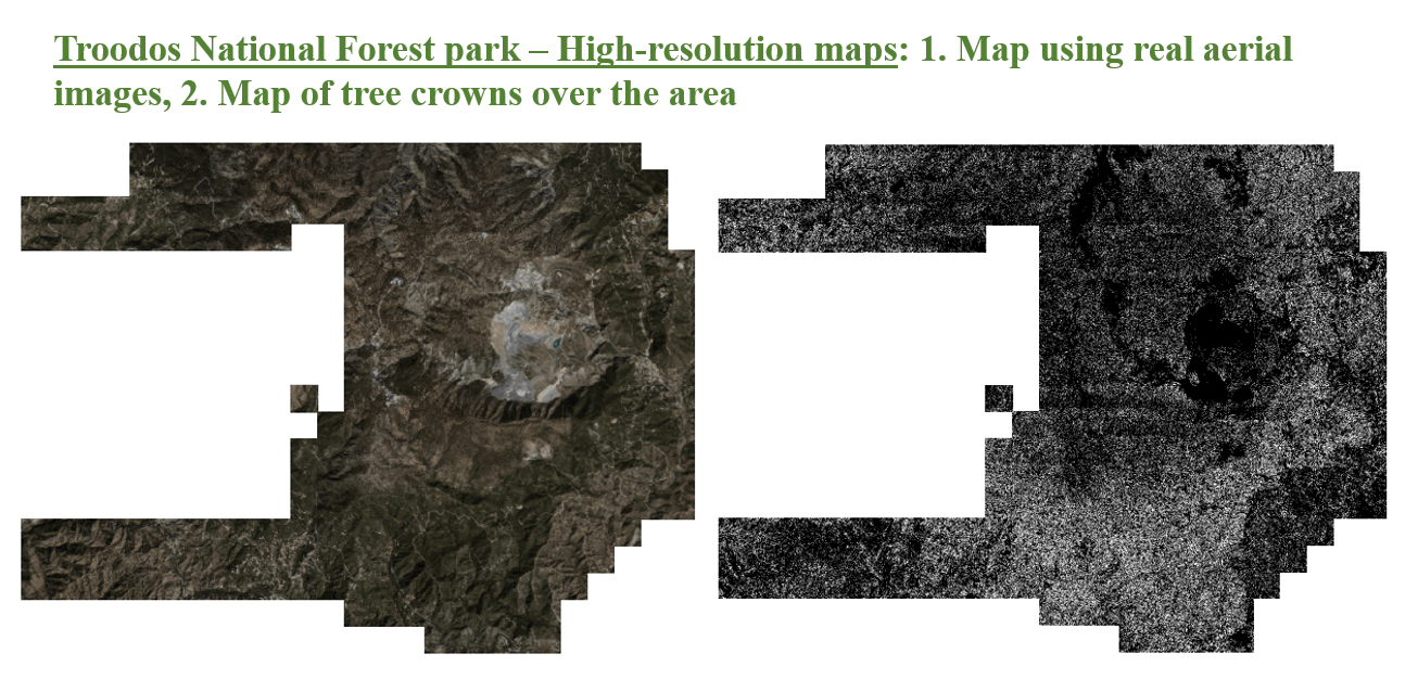
Trees play a vital role in combating climate change by absorbing CO₂ and providing cooling effects. However, in Cyprus—a climate change hotspot facing intensified forest fires and arid conditions—effective land-based mitigation efforts have been hindered by the lack of a comprehensive tree monitoring system. To address this gap, researchers of CARE-C, led by Ms Anna Zenonos, Graduate Research Fellow and PhD student, in collaboration with the Laboratoire des Sciences du Climat et de l’Environnement (LSCE) in France and the University of Copenhagen, in Denmark, have adapted a deep learning neural network, which was previously applied in Denmark and Finland, to analyze 10 cm-resolution airborne images from 2019. The study mapped tree crowns and counted individual trees across 107 square kilometres, including Troodos National Forest Park, Athalassa Forest Park in the capital city, and a small urban area.
Nearly one million trees were identified in Troodos Forest Park alone—an estimate that wouldn’t have been feasible without remote sensing and AI-powered analysis. This research sets the stage for Cyprus’ first national tree-level inventory, enabling more precise forest carbon stock assessments.
To enhance public access to this data, two interactive maps of tree cover have been made available:
Troodos Forest Park Tree Map
Athalassa Forest Park Tree Map
A demonstration video showcasing the map’s features can be viewed here:
Watch the video
This research has been conducted within the context of the Edu4Climate project, funded by the European Commission.
Reference: Zenonos, A., Li, S., Brandt, M., Sciare, J., & Ciais, P. (2025). AI-powered estimation of tree covered area and number of trees over the Mediterranean island of Cyprus. Frontiers in Remote Sensing, 6. https://doi.org/10.3389/frsen.2025.1498217